Spanish Speaking Countries Activities
Maps, Flags & Capitals · Spanish 1
- Grades
- Grades 7–12
- Formats
- Google Slides, PDF, PowerPoint
- Pages
- 36
- Answer keys
- Included
Opens our store on Teachers Pay Teachers, where you can see the full preview and buy.
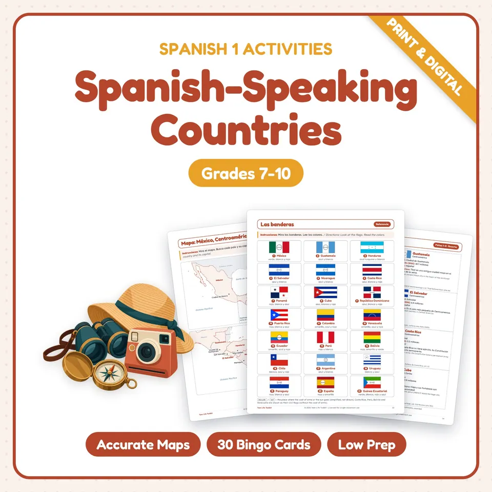
Teach the Spanish speaking countries with accurate maps, flags and capitals your Spanish 1 students will actually use. Students locate all 21 places where Spanish is an official language, by law or in practice (20 countries plus Puerto Rico, a US territory), learn each capital, region, flag and nationality, read country profile cards with dated population figures and checked facts, then play capitals bingo, solve task cards and present a "País de la semana."
What's included
- Teacher guide (2 pages): 6-day pacing, differentiation, and clear notes on the facts (Puerto Rico's status, where Spanish is official by law, Bolivia's two capitals, Equatorial Guinea's new capital since January 2026)
- Standards page: ACTFL World-Readiness Standards, Novice Mid to Novice High can-do goals, an interpersonal speaking rubric for the partner interview, and contents
- Reference chart: all 21 places with flag, capital, region and nationality (masculine and feminine)
- 3 labeled reference maps: Mexico, Central America and the Caribbean; South America; Spain and Equatorial Guinea with a world map
- 3 practice maps to label + a world map to color
- Flags page (21 flags with their colors) + flag practice: identify, describe with color agreement, compare
- 21 country profile cards: capital, population (2025), official spoken languages (national and regional) and a fun fact with its source, plus a make-your-own card
- Card hunt with más/menos comparisons and a partner interview (scored with the speaking rubric)
- Novice reading "Hola desde el mundo hispanohablante" (six teens) with glossary and a 4-part question page
- Capitals matching (21) and sentence writing
- 2 map quizzes (place + capital, 42 points)
- 16 task cards + recording sheet
- Capitals bingo: 42 caller clues + 30 different cards
- "País de la semana" project page with a 16-point rubric
- 6 exit tickets
- Complete answer keys
How to use it
Use it in the first weeks of Spanish 1 (grades 7-10), during Hispanic Heritage Month, or any time you introduce the Spanish-speaking world. Teacher pages are in English; student pages give directions in Spanish followed by English. Every map is drawn by computer from public-domain Natural Earth map data, never traced by hand. Flags are drawn exactly (Honduras in the turquoise named in its flag law); where a flag has a coat of arms or the Sun of May, a clearly labeled outline marks its place instead of a guessed emblem. Populations are World Bank estimates for 2025, rounded and dated.
Skills practiced
Countries, capitals and regionsmap skillsflags and color agreementnationality adjectivesser de / estar enmás / menos comparisonsreading for informationasking and answering questions